Land cover change detection using TIMESAT software and machine learning algorithms near Ujani Dam: A case study
Keywords:
TIMESAT, Seasonality Parameters, Decision Tree, Random Forest, Naïve Bayes, Forest algorithm, MATLAB, Vegetation cover, Land use, satellite imagesAbstract
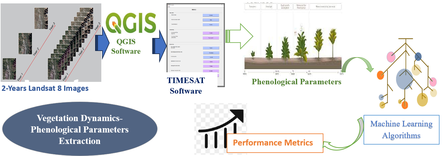
This work focuses on the case study of vegetation dynamics using Machine Learning algorithms on satellite time series data. Vegetation covers a substantial portion of the Earth’s land surface, having an important role in the Earth’s energy balance. Several factors, such as climate, abiotic environments or biotic interactions, and the dynamics of population and their activities have a great impact on the vegetation processes. Estimation of phenological and seasonal parameters is mainly used for land cover change detection. Estimation of seasonal parameters requires high spatial and temporal resolution data. Time-sequence of vegetation index data from Landsat 8 is used for monitoring vegetation seasons and for investigating and obtaining seasonality-related factors. This research focuses on obtaining seasonal parameters using the TIMESAT program package available in MATLAB. Preprocessing of Satellite images is done to remove the effect of noise and cloud. The comparative analysis is done for four different time sequence smoothing techniques like asymmetric Gaussian, Savitzky-Golay, and Seasonal Trend Decomposition using LOESS (STL), and Double-logistic functions. It is seen with an output of TIEMSAT that Double logistics gives the best result verified in situ. Further, to avoid human interference, and to get better accuracy in the prediction of phenological parameters, different machine learning techniques are applied to TIMESAT output, and performance parameters like f1-score, accuracy, and precision are compared. Random Forest, Decision Tree, and Naïve Bayes methods are used where the suggested, Naïve Bayes algorithms along with a Double logistic filter give enhanced 94% accuracy with a precision of 96 % as compared to the Decision tree and random Forest algorithm.
URN:NBN:sciencein.jist.2024.v12.717
Downloads
Downloads
Published
Issue
Section
URN
License
Copyright (c) 2023 Manisha Kumawat, Arti Khaparde

This work is licensed under a Creative Commons Attribution-NonCommercial-NoDerivatives 4.0 International License.
Rights and Permission

